Nearly a decade ago, the immersive augmented reality game Pokémon Go revolutionized mobile gaming by transforming real-world environments into a vast digital playground. Millions of players worldwide ventured into parks, bustling streets, and even secluded alleyways, phones in hand, to capture virtual creatures superimposed onto their surroundings. What players might not have realized then was that their enthusiastic pursuit of Pikachu and Charizard was also inadvertently contributing to a monumental crowdsourcing effort. This week, it was revealed that this vast trove of real-world imagery, collected by players, is now set to help autonomous delivery robots navigate their routes.
Niantic Spatial, a division of the company behind Pokémon Go, recently announced a significant collaboration with Coco Robotics, a firm specializing in short-distance food and grocery delivery robots. Under this partnership, Coco’s robotic couriers will soon utilize Niantic Spatial’s advanced Visual Positioning System (VPS). This sophisticated navigation tool can pinpoint a robot’s location with remarkable accuracy—down to just a few centimeters—by visually analyzing nearby buildings and landmarks. Crucially, the VPS model was extensively trained on over 30 billion images meticulously captured by Pokémon Go users, promising to enhance robot operation in areas where traditional GPS signals often falter.
In essence, the countless hours players spent exploring and mapping their physical environments for virtual rewards are now directly influencing the efficiency and precision with which a delivery robot can bring your next meal to your doorstep. This collaboration stands as a compelling illustration of how data, initially gathered for one purpose, can be ingeniously repurposed years later for an entirely different, yet equally impactful, application.
John Hanke, CEO of Niantic Spatial, highlighted the surprising synergy in a recent interview: “It turns out that getting Pikachu to realistically run around and getting Coco’s robot to safely and accurately move through the world is actually the same problem.”
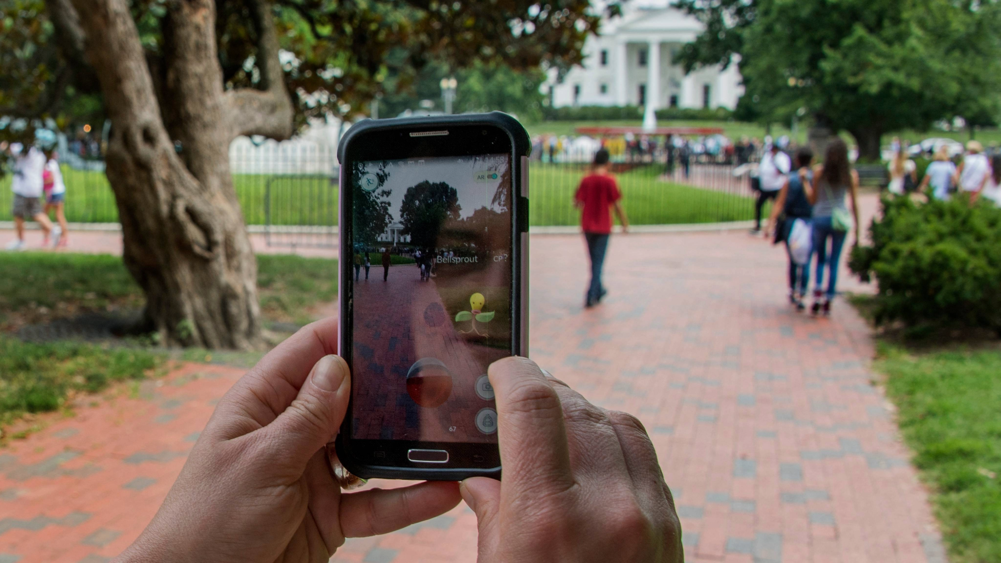
Photo: popularscience.com
How Virtual Adventures Create Real-World Maps
Unlike GPS, which relies on satellite signals for navigation, VPS determines location based on visual recognition of surrounding features. This makes Pokémon Go an exceptionally rich source of data, as players actively traveled to diverse locations and interacted with their phones at various angles. The data collection received a significant boost in 2020 when the game introduced “Field Research” tasks, encouraging players to scan real-world statues and landmarks with their phone cameras in exchange for in-game rewards. Additional data was also reportedly gathered from specific areas known as “Pokémon battle arenas.”
Unbeknownst to many players, these extensive scans were instrumental in creating detailed 3D models of the real world, which subsequently formed the foundation of Niantic Spatial’s VPS model. The sheer volume of data is key to accuracy; by collecting images of the same locations from numerous users, the system could capture these spots under varying weather conditions, lighting, angles, and heights. At its peak in 2016, Pokémon Go boasted approximately 230 million monthly active players, and even today, it maintains a considerable user base, estimated at around 50 million active users.
Precision Navigation Beyond GPS
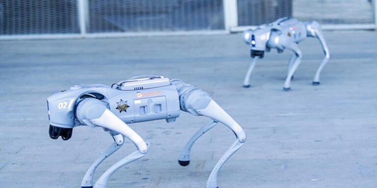
Niantic Spatial and Coco are banking on the robust dataset from Pokémon Go to enable delivery robots to ascertain their precise location simply by recognizing ambient landmarks. While most autonomous robots currently rely on GPS, its dependability can be inconsistent, particularly in urban environments. Instances of delivery robots getting disoriented or struggling to cross streets on college campuses are not uncommon, leading to frustrating delays. For time-sensitive food deliveries, such reliability is paramount.
“The promise of last-mile robotics is immense, but the reality of navigating chaotic city streets is one of the hardest engineering challenges,” Hanke remarked in a statement.
Although GPS unreliability is often associated with remote or rural areas, it’s equally problematic in dense urban landscapes. Tall, closely packed buildings frequently obstruct satellite signals, causing location markers to drift erratically on maps. The intention is for Coco’s robots, equipped with VPS and four onboard cameras, to achieve a far more precise understanding of their immediate surroundings, thereby ensuring timely and accurate deliveries.
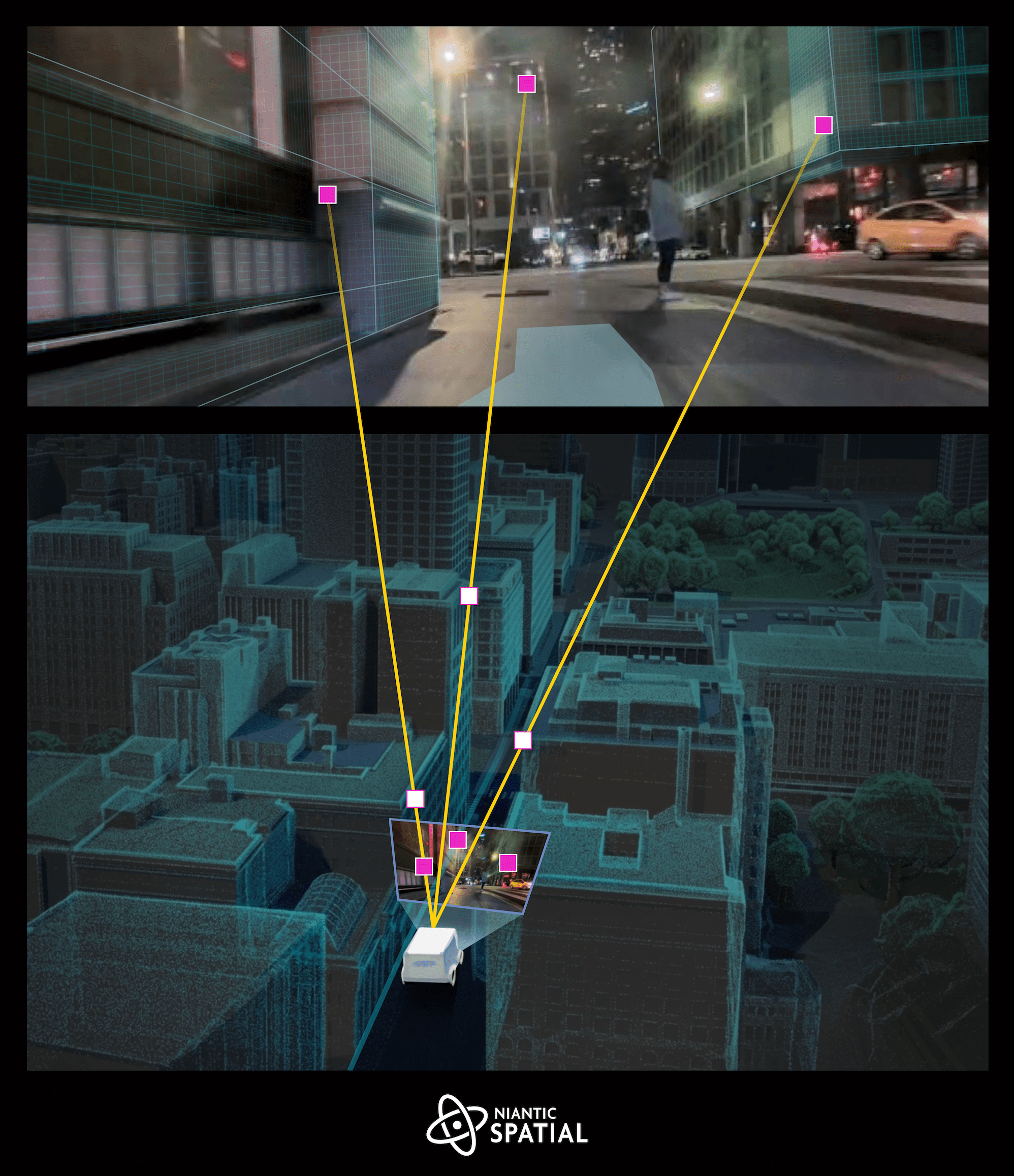
Photo: popularscience.com
The Broader Implications of Crowdsourced Mapping
This collaboration isn’t an isolated incident where data, freely gathered by internet users for one purpose, is later repurposed for another. Famously, Google’s CAPTCHA tests, which require users to identify objects like traffic lights, have long been suspected by computer scientists of secretly helping to train AI vision models. More recently, law enforcement agencies have allegedly accessed or purchased user-generated content from consumer mapping tools like Waze for investigative purposes. While Niantic Spatial has not indicated any plans to share its VPS data with authorities, it underscores how a tool capable of pinpointing precise locations from photographs could attract interest from various sectors.
On a broader scale, Niantic Spatial views its partnership with Coco Robotics as a crucial step towards building a “living map” of the world. This dynamic map would continuously update as new data becomes available. Once VPS-equipped delivery robots are deployed, they will further contribute to this data pool, enhancing the model’s accuracy over time. This continuous, real-world data collection strategy is fundamental to the advancements seen in self-driving vehicle companies such as Waymo and Tesla in recent years.
So, the next time you observe someone immersed in a virtual scavenger hunt, remember that their pursuit of digital creatures could very well be playing a vital role in ensuring that the pizzas of the future arrive at their destinations exactly when expected.

Photo: popularscience.com